
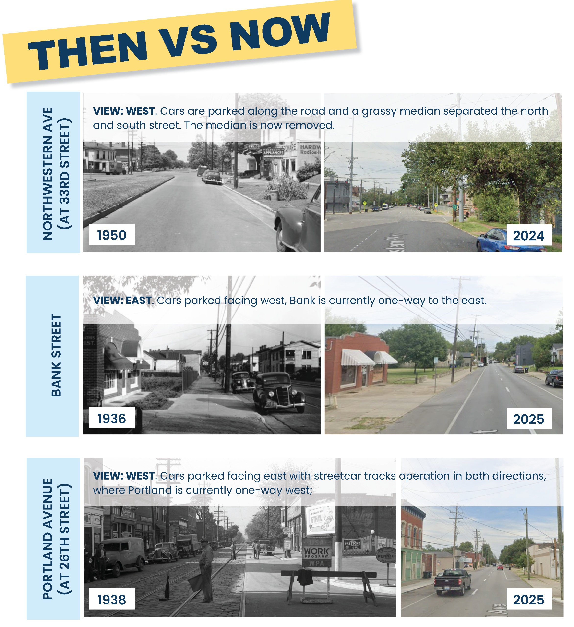
History & Conversion Context
The Kentucky Transportation Cabinet (KYTC) is studying portions of Portland Avenue, Bank Street, Northwestern Parkway, 15th Street, and 16th Street. The goal of the study is to enhance safe mobility for all users and improve corridor connectivity. The project team wants to hear your feedback on how to best accomplish these goals.
Image 1 of 6

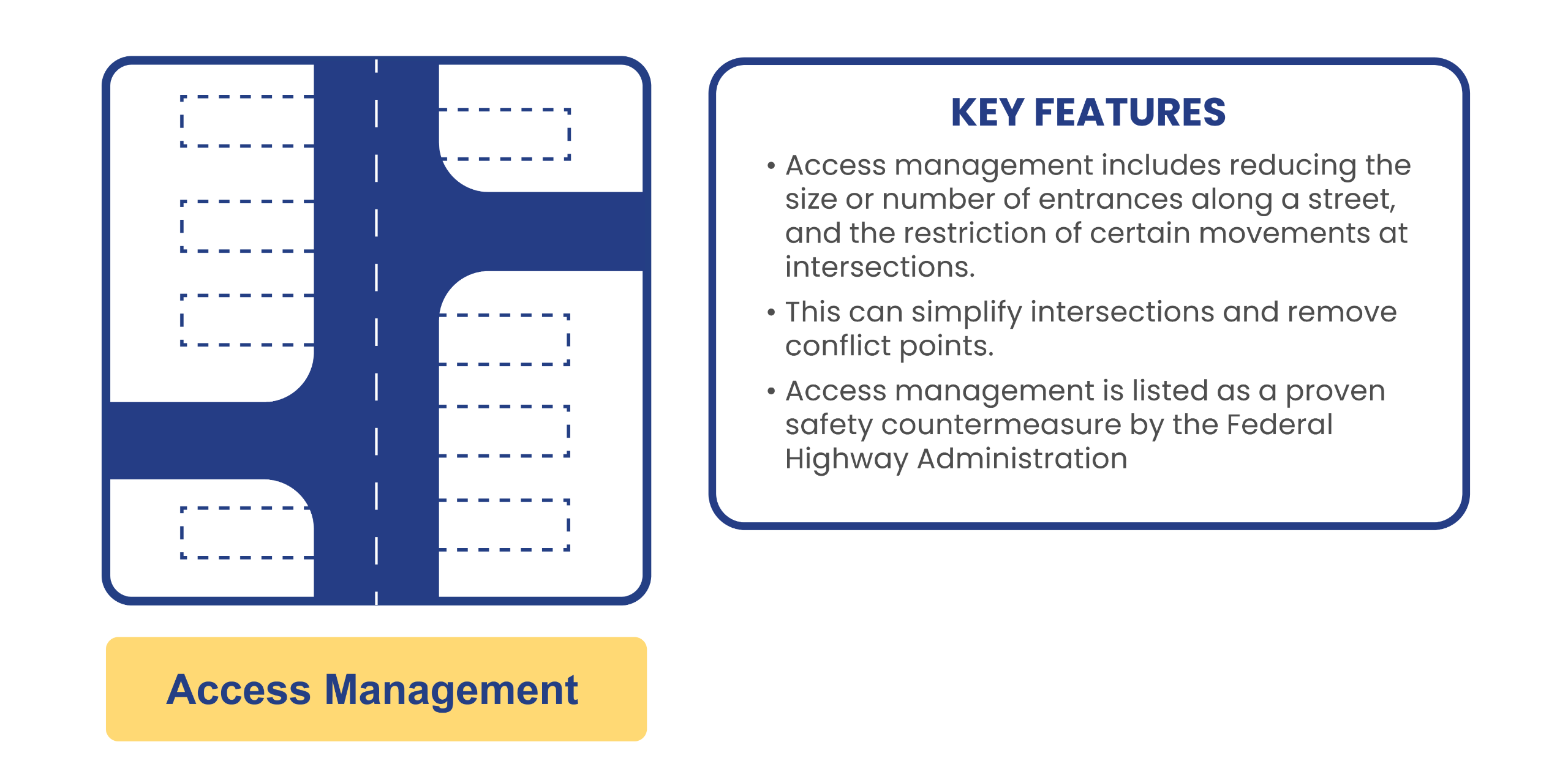
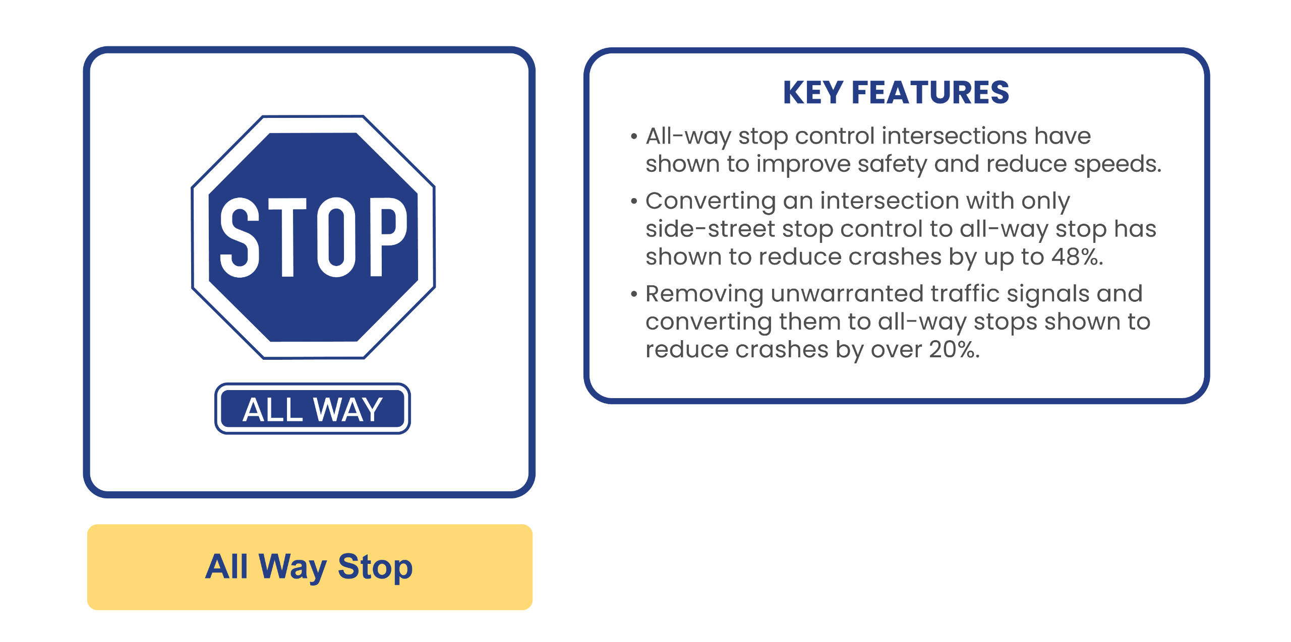
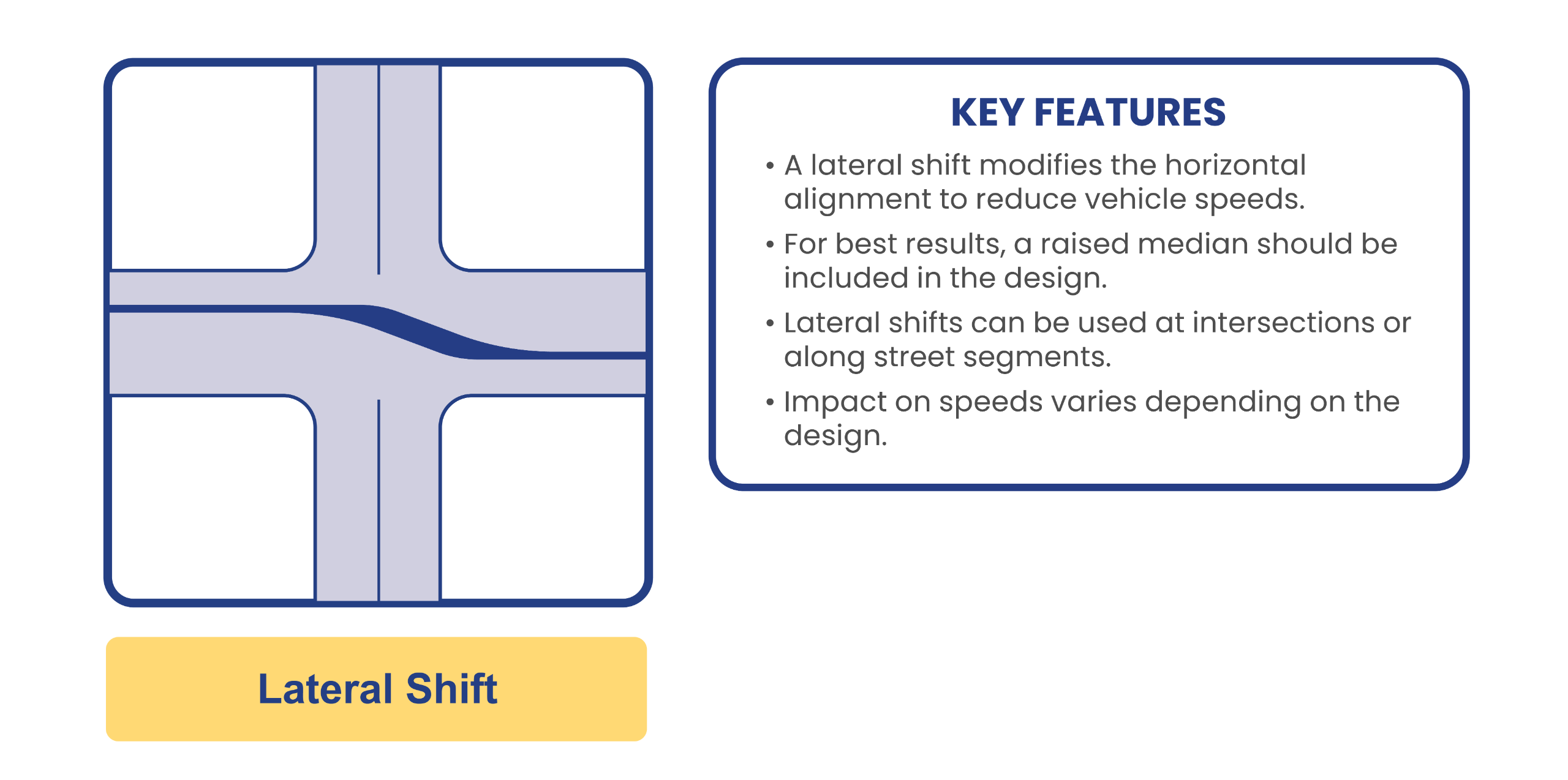
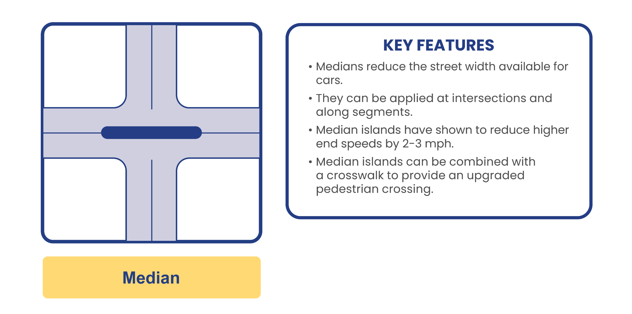
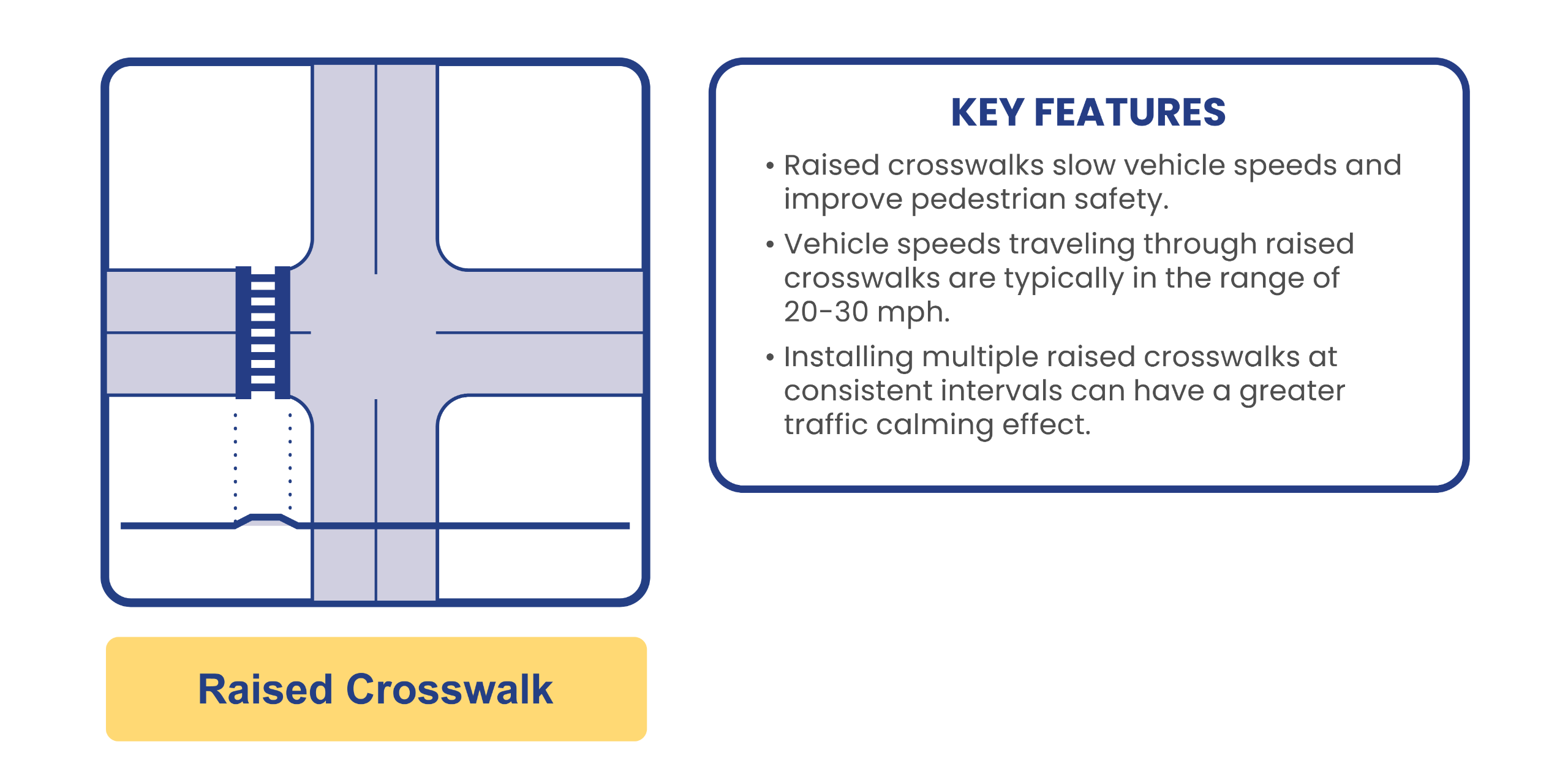
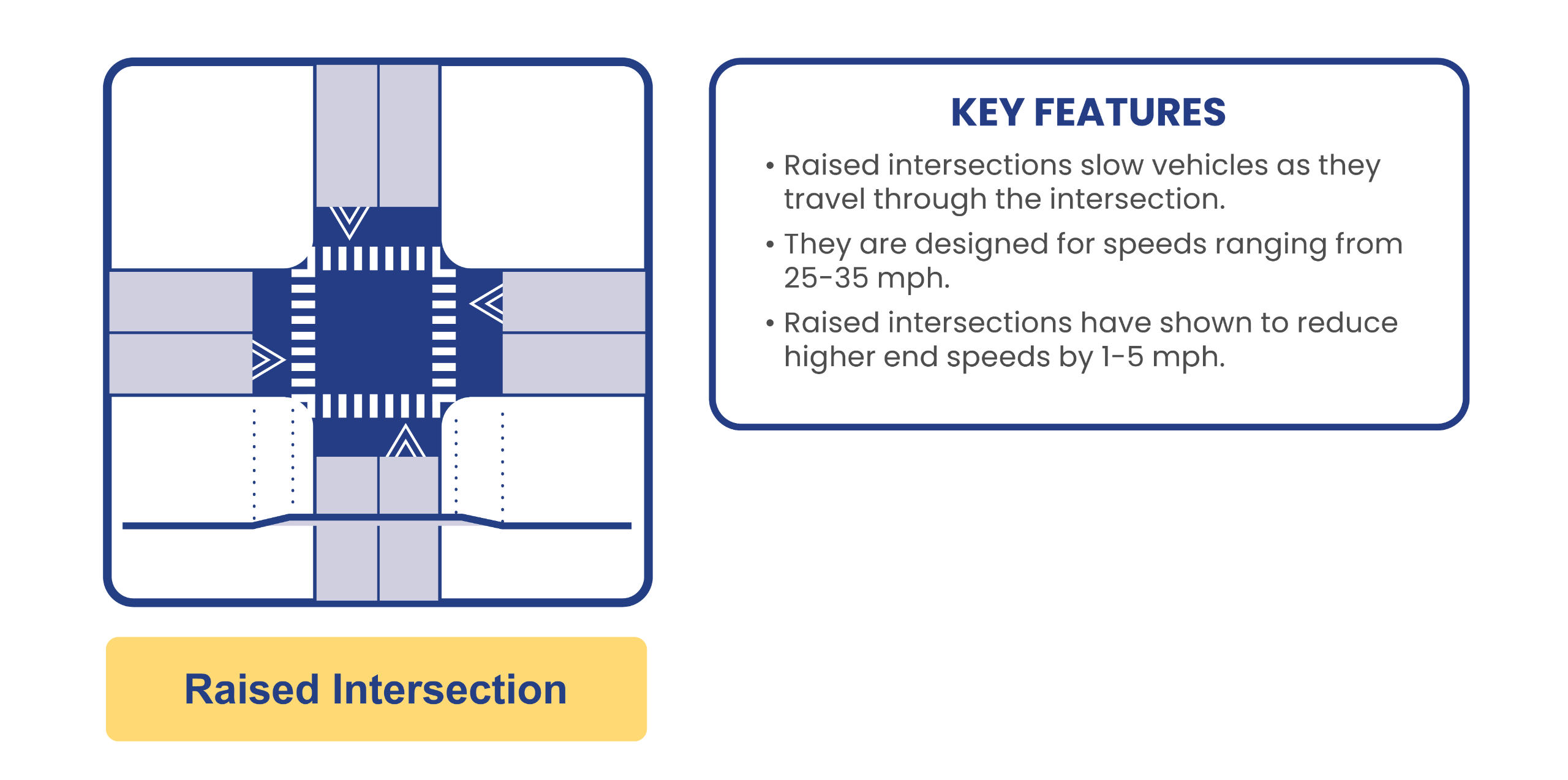
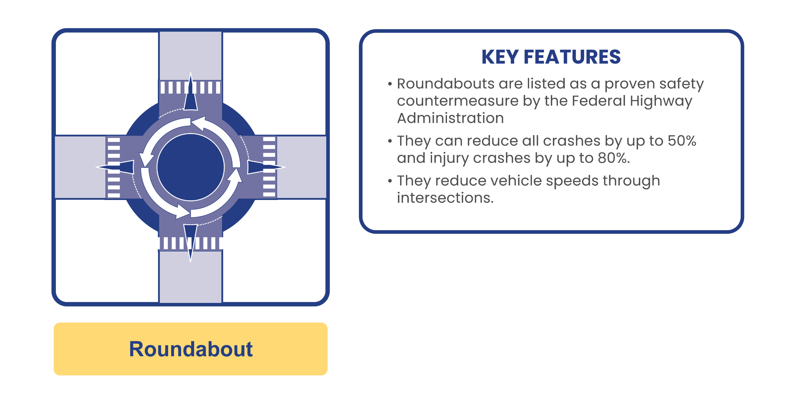
Traffic Calming Measures
Image 1 of 8

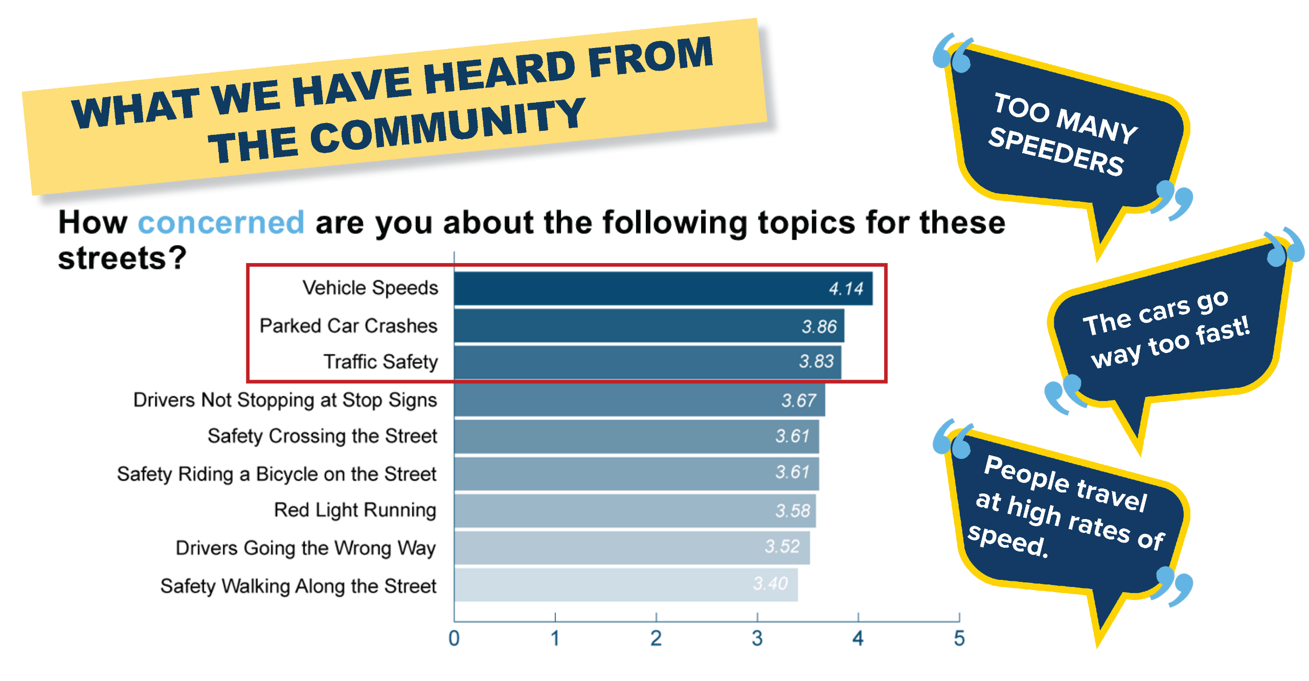
Public Survey 2
Rate Measures
Map Activity
Alternative Concepts
Alternative Concepts
Review the below graphic representations of four (4) key locations in the study area. Shift the slider left to right to view the existing (left) and an alternative option (right). Then, please answer the questions at the bottom of this page.
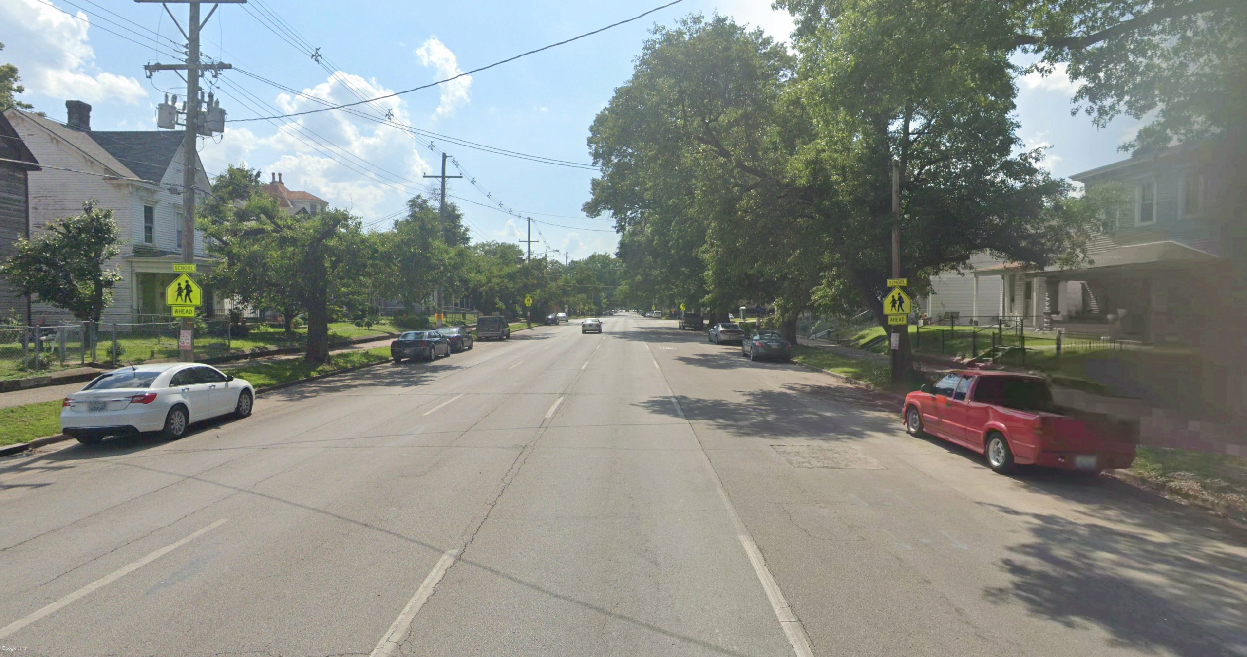
Northwestern Parkway
Northwestern Parkway between 31st Street and 39th Street is very wide, featuring 3 west-bound lanes, a west-bound on-street bike lane, and parking on both sides. Generous sidewalks are provided. The roadway is lined with lawns with a few remaining mature trees. With such a wide roadway, drivers routinely speed through the corridor. Speed reduction through traffic calming and lane reduction is critical.
Alternative A
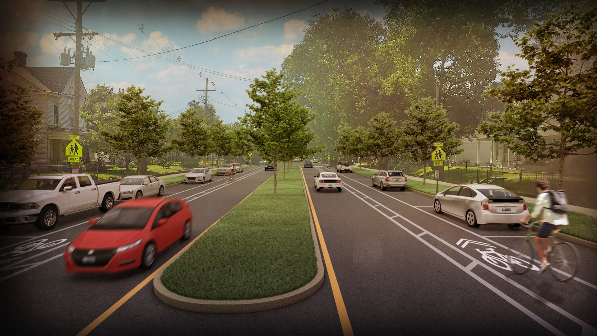
At one point, this segment of Northwestern Parkway featured a landscaped center median, which reduced the number of lanes. This Alternative replaces that median, which works very well with a two-way road configuration. On-street bike lanes and parking are provided on both sides of the roadway. Sidewalks are improved and new trees are planted in the median and both sides of the street.
Alternative B
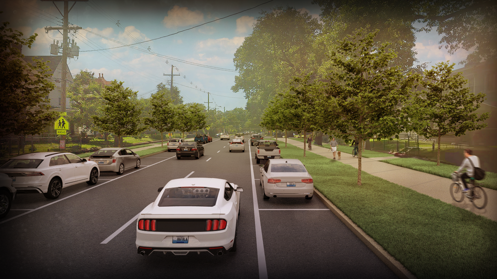
This Alternative reduces the roadway to two west-bound lanes, with parking on both sides of the street. The curbline on the south side of the street remains, while the north curb is shifted inward to reduce the width of the street. This creates an opportunity for a wide multi-use pathway with generous open space on each side. Trees are planted on both sides of the pathway and on the south side of the street.
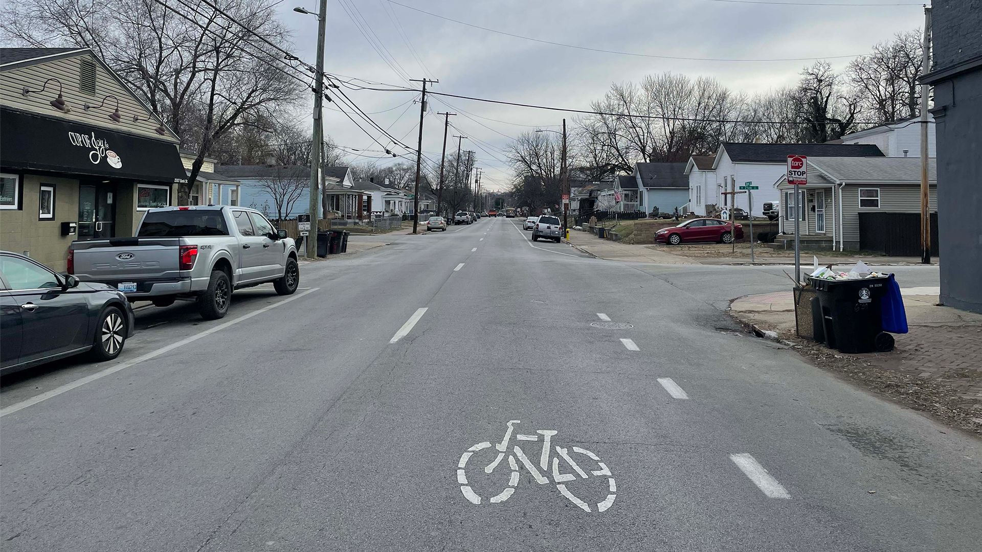
Bank St at 25th Street
Many intersecting side streets like 25th Street at Bank Street are offset or not aligned on either side of the street. Since Bank is a one-way street, it is difficult for drivers to continue north and illegal for drivers to continue south along 25th Street. Residents frequently see illegal driving at many similar locations in the study area. Traffic calming measures are critical in these locations.
Alternative A
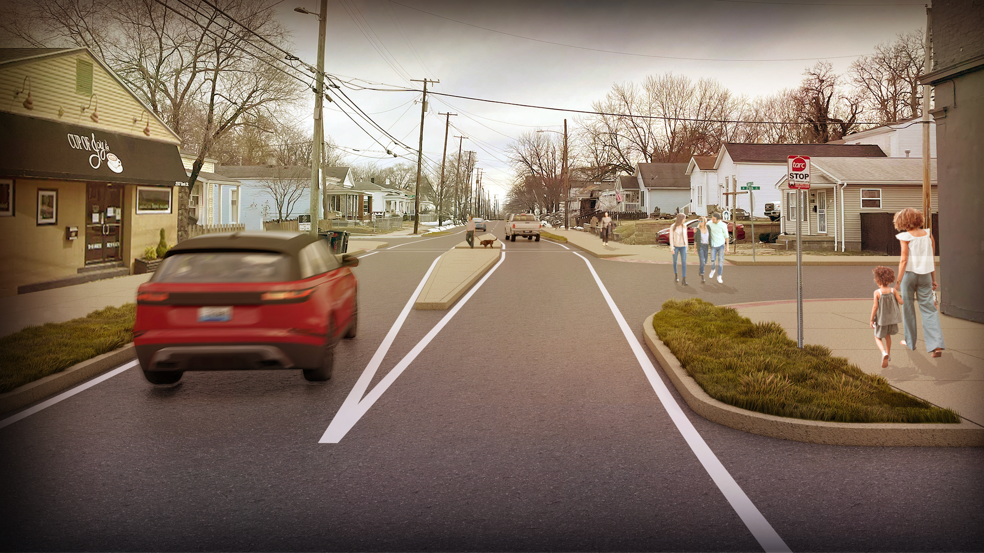
In this Alternative, a median is placed in the 25th Street intersection. Its placement prevents drivers coming from the north from driving the wrong way down the one-way Bank Street. Regardless of direction, all drivers must turn at Bank Street. The median incorporates a mid-block pedestrian crossing, and, combined with curb extensions, also serves to slow through traffic on Bank Street.
Alternative B

In Alternative B, Bank Street is converted to a two-way street. This simplifies the function of this and similar offset intersections, as turns in either direction are legal, allowing both north and south-bound crossing of Bank Street at the intersection. A raised crosswalk and curb extensions are placed at the intersection to improve safety for pedestrians and to keep parked cars back from the corners for visibility.
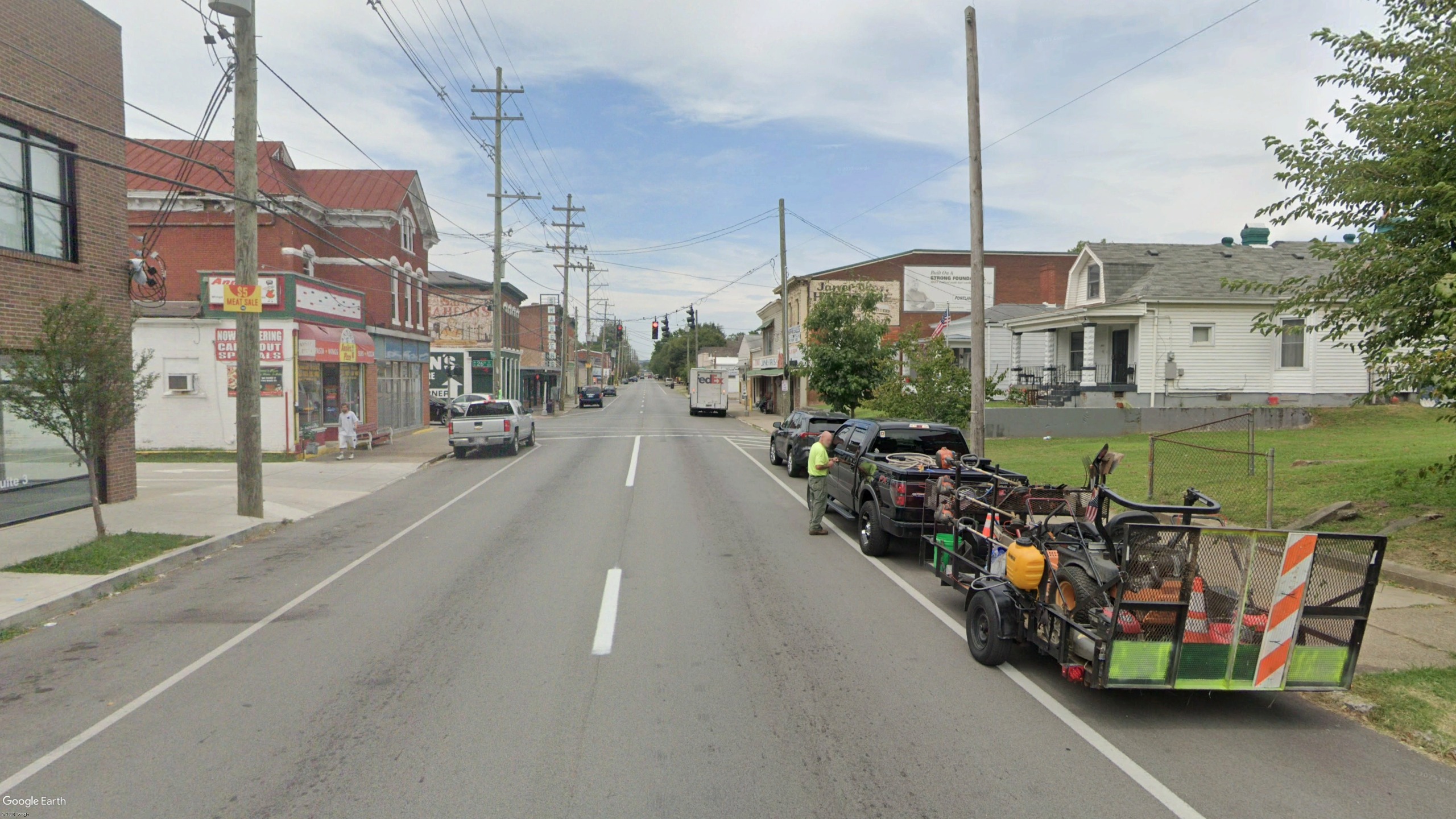
Portland Avenue at 26th Street
The intersection of 26th and Portland Avenue is the heart of the business district in the neighborhood. Here, Portland Avenue features two west-bound lanes with parking on both sides with a signalized intersection. Another of the offset intersections, pedestrian and driver safety is also impacted by the demand for on-street parking and the need for loading areas for local businesses along the street.
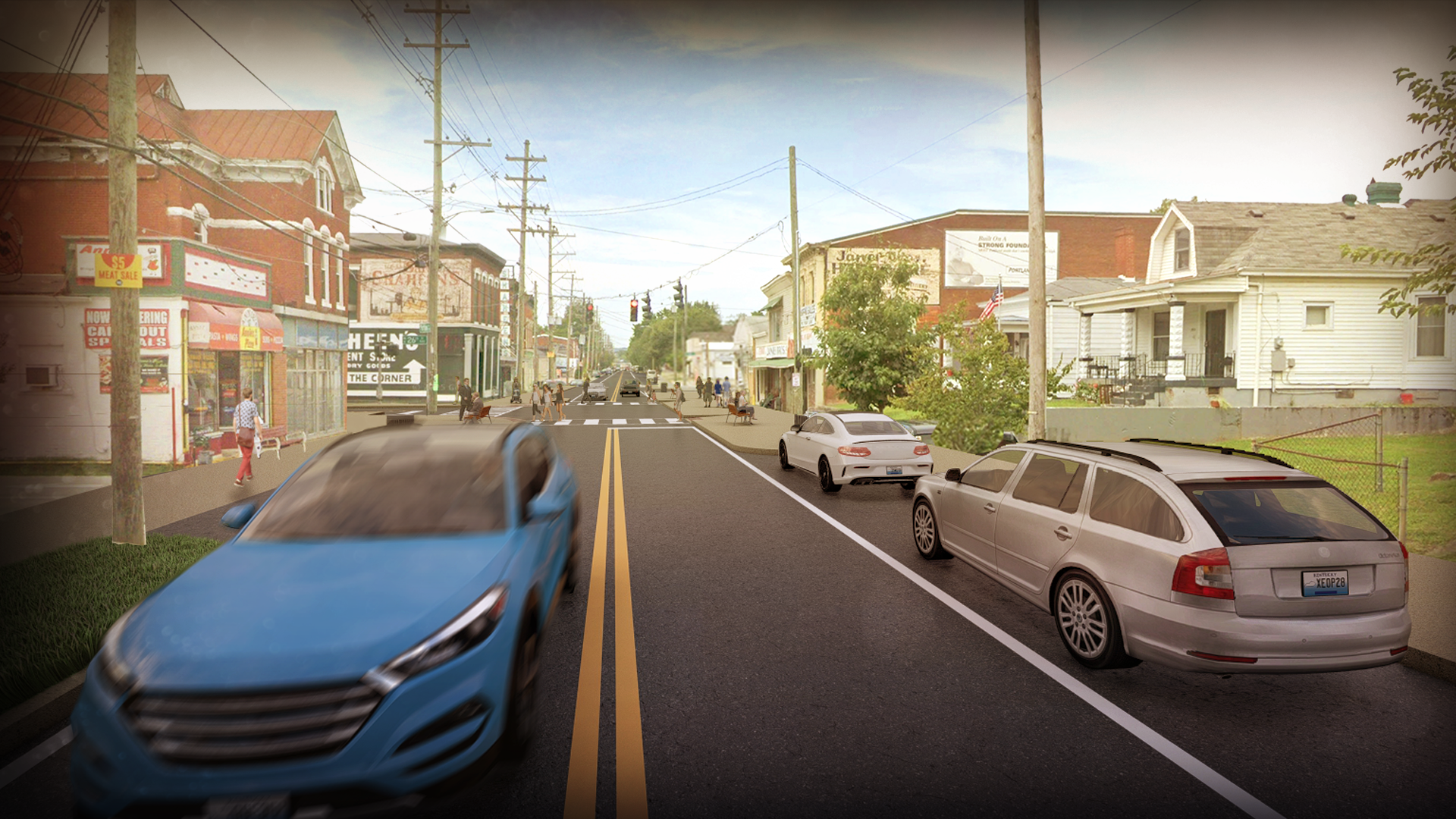
To improve the function of the intersection, increase driver visibility, and make safer pedestrian crossings, curb extensions are added between the legs of 26th Street, minimizing on-street parking within the intersection. Pedestrian areas are added in front of businesses allowing for sidewalk and outdoor spaces. Portland Avenue is a two-way street in this alternative.
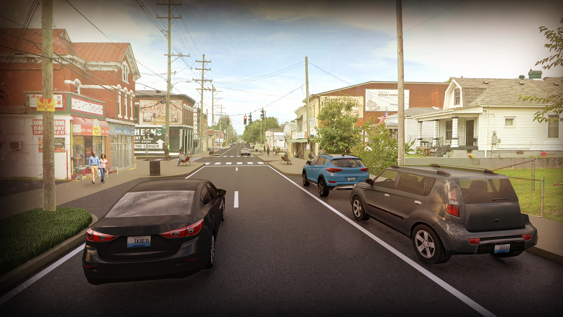
While remaining one-way, this alternative adds curb extensions between the legs of 26th Street, improving the intersection and safety, while minimizing on-street parking within the intersection. Pedestrian areas are added in front of businesses allowing for sidewalk and outdoor spaces. In both alternatives, loading zones for businesses are important considerations and will factor into the recommendations.
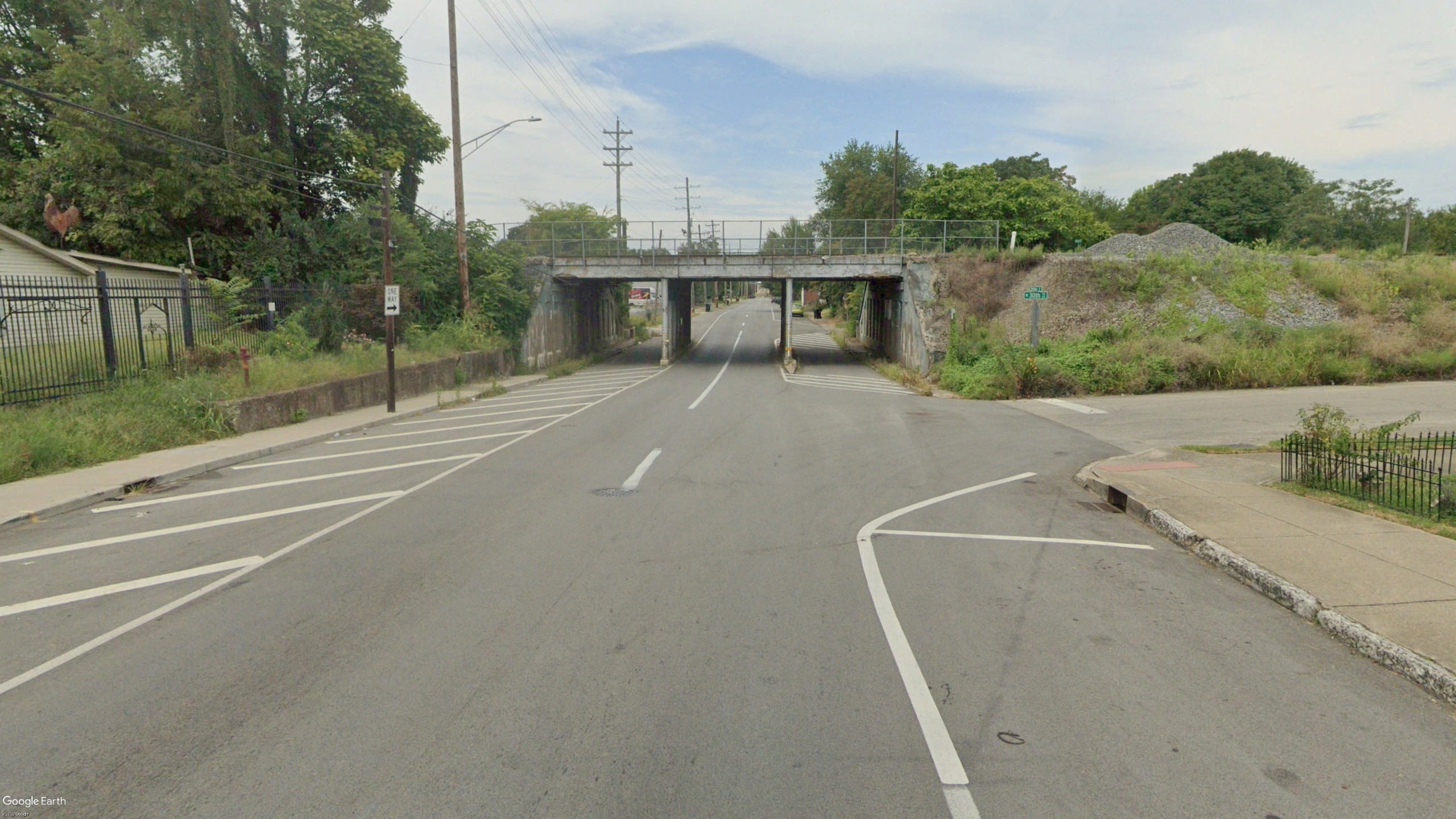
Portland Avenue at Railroad
The railroad viaducts on Portland Avenue and Bank Street are frequently identified as neighborhood concerns. On Portland Avenue, two 10’ wide lanes pass through the center span of the viaduct, while pedestrian facilities are limited to a narrow (4’ wide) sidewalk on the south side. The sidewalk on the north side is not passable. Lighting is not provided and the underpass is very uninviting.
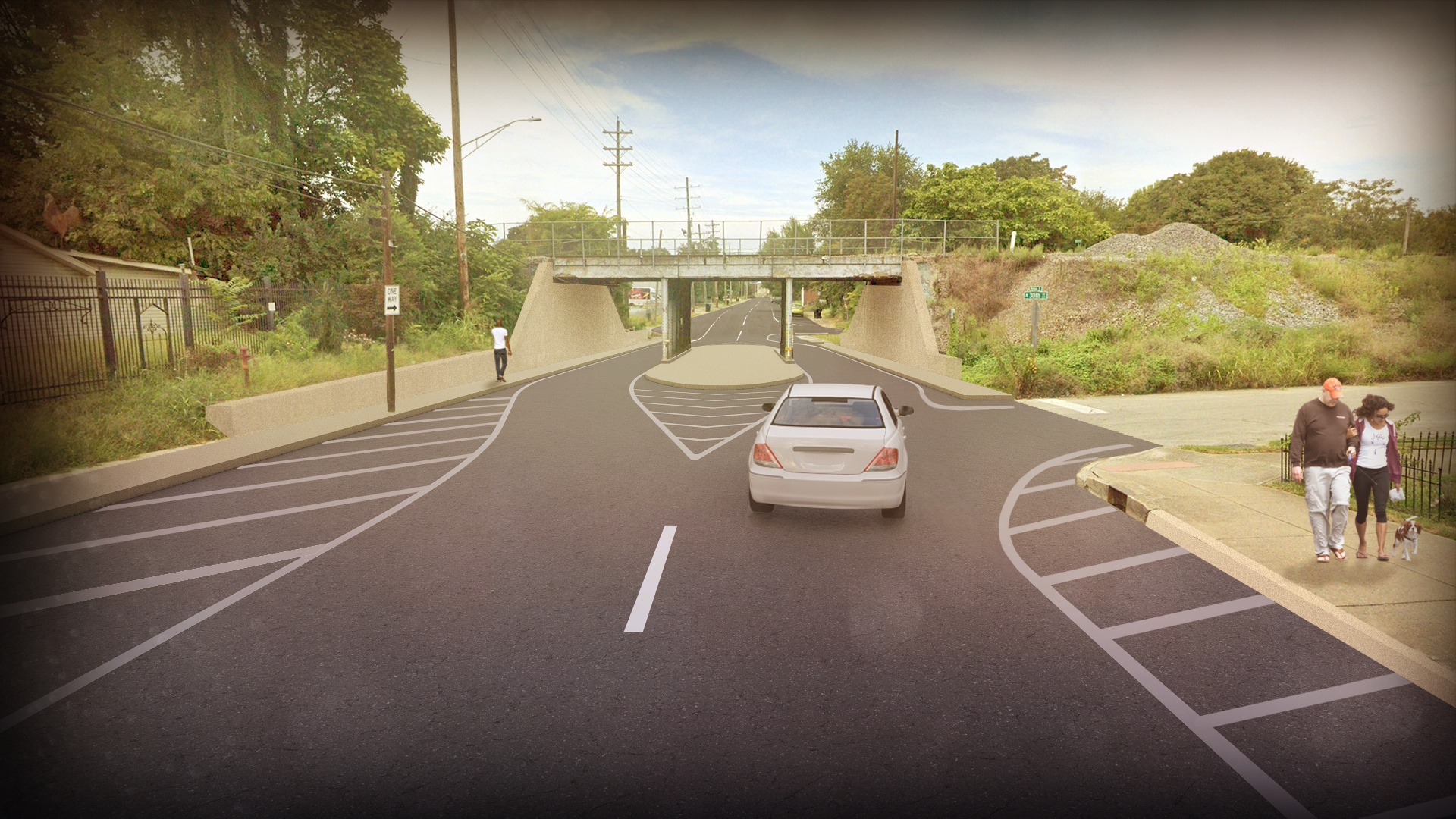
In this alternative, a center median is placed in the center span of the viaduct. Via this lateral shift, drive lanes are shifted to lanes in the outer spans of the bridge slowing traffic and allowing for wider 12’ drive lanes. Sidewalks on either side of the outer spans are rebuilt, while under-bridge lighting is added to make for a more inviting experience.
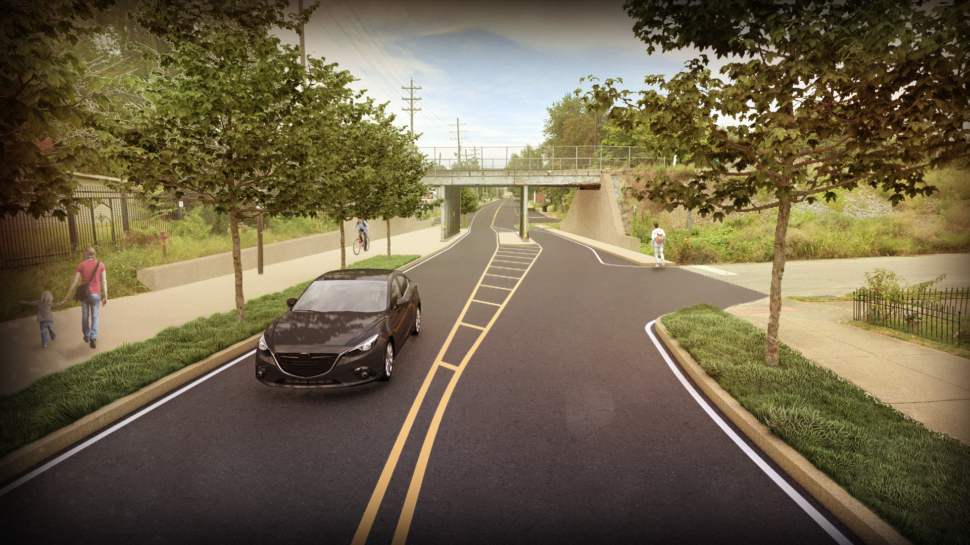
Alternative-B separates drive lanes, with a west-bound lane in the north span and an east-bound lane in the center span. By shifting to these more generous lanes, the south span of the viaduct can be utilized for pedestrians with a wide multi-use path taking advantage of what is mostly unused space today. The lane shifts also create more space for street trees. Under the bridge is cleaned-up and features new lighting.


